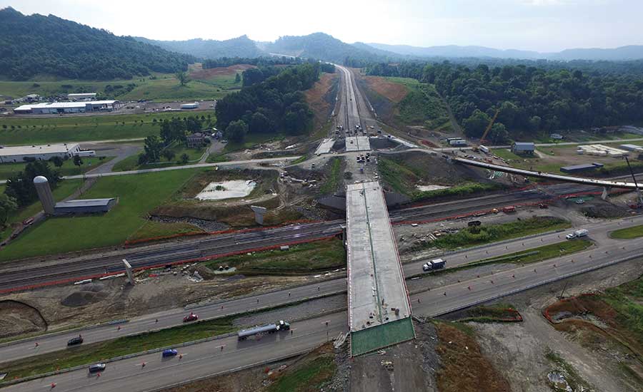
For more than 50 years, Ohio Dept. of Transportation officials have been talking about bypassing Portsmouth, Ohio, the county seat of Scioto County. By entering into a public-private partnership and allowing the P3 to write new specifications and adopt innovations from highway projects around the U.S., the agency not only got construction moving, but also reduced the overall project delivery time by 17 years. But to complete the job by the end of next year, crews still must excavate through millions of cubic yards of rock.
ODOT and its public-private partner, a coalition of construction companies and private developers known as the Portsmouth Gateway Group, are constructing a 16-mile, four-lane, $429-million bypass of Portsmouth. Now known as the Southern Ohio Veterans Memorial Highway/State Route 823, the effort is ODOT’s first major P3 and the largest single roadway construction project in state history. Local officials hope the project, which will allow quick access between nearby cities, will also boost development.
Article Index:
50 Years of Planning
With a population around 20,300, Portsmouth is not a bustling metropolis like Cleveland or Cincinnati. Its population has steadily declined since the 1940s, according to the U.S. Census Bureau. Both the Scioto and Ohio rivers have carved valleys near Portsmouth. Hilly, mostly sandstone terrain and thick forests make it difficult to get anywhere in the vicinity without traversing a network of winding, two-lane back roads.
It’s no surprise that the area remains largely undeveloped.
“Basically, the No. 1 issue we have right now is the lack of available, usable sites for buildings for economic development purposes,” says Jason Kester, development director for the Portsmouth-based Southern Ohio Port Authority. “We have either hellacious brownfield or floodplains, side of a hill sites or cornfields with no gas, water or fiber-optic access.”
The highway team hopes to change that. “This project is about getting travel in and out of Appalachia fast and efficiently,” says Tom Barnitz, ODOT’s project manager for the SOVMH. “In the 1960s, the federal government put together the Appalachian Development Highway System. They mapped out corridors that were economically disadvantaged, like Scioto County, to urban areas. This is literally the last part of the ADHS in Ohio.”
ODOT was planning to bid out the project, which bypasses 80 intersections and 30 traffic signals, in early 2011 as a three-stage project, building the middle section first. However, that same year, the Ohio Legislature passed a law allowing P3s, broadening ODOT‘s construction options.
“We had money coming in from several sources, we just couldn’t promise or guarantee a schedule for the second and third stages,” says Kathleen Fuller, ODOT district 9 spokeswoman. “This was a way to sell it as a single project and have this done at once.”
Delivering all 16 miles as a P3 shaves 17 years off the original three-phase construction timeline and allows ODOT to pay off the construction costs over 35 years, Fuller says.
The P3 Plan
The Portsmouth Gateway Group—a consortium that includes Dragados USA Inc., Beaver Excavating Co., John R. Jurgensen Co., ms Consultants, ACS Infrastructure Development, Infrared Capital Partners Limited and Star America Fund GP—won the project over two other bidders in 2013. Construction began two years later. The PGG fully embraced the one-stage project and set a five-year design and construction timeline for completion.
“Sometimes when a project is done in stages there’s different designs that are not properly balanced,” says Hugo Fontirroig, project manager for Dragados USA. “They are only balanced partially for that stage. From a design standpoint, taking into account the massive excavation required, it actually makes the project much more cost effective, doing it as one project.”
The design-build-operate-maintain P3 contract stipulates that PGG must fund initial construction and build the road for an estimated cost of $429 million. State funds, however, will pay back any loans, interest and related charges over time. The PGG will also be responsible for maintaining the road through 2053, so ODOT’s total cost for the project could balloon to $1.2 billion over the term of the maintenance contract. Only full compliance to a rigid set of requirements can result in full payment for construction, operations and maintenance. There’s a two-year handover compliance period at the end of the contract when the PGG will give the road back to ODOT in 2052-2053.
“When ODOT put the contract together, we threw out our specifications book and basically wrote performance-based specifications for the entire payback period,” says Bill Maddex, CEO of PGG. “Rather than standard construction specs, we have a smoothness of the road standard that’s written just for this project, and (PGG) will be required to meet that monthly. If there are deficiencies in the smoothness of the road, we will see a deduction in payment.”
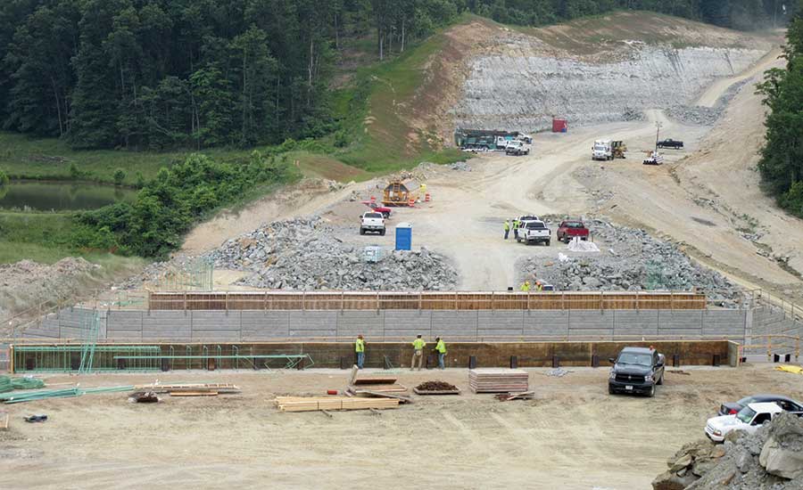
Maddex adds that the project has unique “performance-based specifications for everything from MSC walls to signage to graffiti, litter, debris in the road and all types of those asset descriptors written into the contract.”
Freed from its normal rules thanks to the P3 structure, ODOT allowed PGG to bring in criteria from any DOT, any construction method or state program to provide innovation in construction and design on the project (see sidebar). ODOT only said no to a construction specification or method if it wasn’t reimbursable by the federal dollars that back the project, Barnitz says.
Sandstone Hills and Deep Valleys
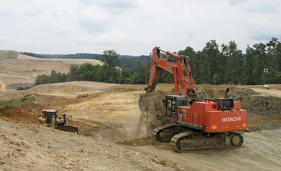
Designed to minimize environmental impact and maximize land for business development, the selected route provided significant hurdles for PGG. The quick-access corridor for motorists came with a major trade-off: a requirement to remove 20 million cu yd of earth composed of 95% rock.
“It’s a tremendous challenge in terms of topography and the massive size of the cuts we have had to make,” says Neil Richards, vice president and construction quality manager with design engineer HDR. “The normal thought process would be to take the least-challenging path, from a constructibility standpoint, with the topography you have, but the idea of the Appalachian Development Highway System is you want to maximize the available land area for economic development.”
Beaver’s project manager Chad Ratkovich said that about 17 million of the 20 million cu yd have been removed to date and that they are on schedule to open the road to the public in December 2018. The excavation has required multiple daily shifts a day removing rock and using it for infill on other parts of the project.
What About Jobs?
As for the economic opportunity the SOVMH promised? It’s starting to trickle in.
PureCycle Technologies, a recycler of polypropylene products, is planning a chemical process plant in the area. A PureCycle executive said a major factor in the company’s decision to invest was that the highway will make the trip from Ironton, Ohio, to Columbus 14 minutes faster.
The Southern Ohio Port Authority intends to enter into a preliminary development agreement with another company to construct a 150,000-sq-ft building at the airport exit of the SOVMH. Southern Ohio Port Authority’s Kester says that construction could begin next spring, depending on the results of a feasibility study.
Beaver Excavating’s Ratkovich says his company has plans to keep operations in the area, thanks to other nearby work it has won.
Despite these development inroads, the U.S. Public Interest Research Group (PIRG) and the Frontier Group labelled the SOVMH a “highway boondoggle” in 2016, arguing that the money could have been better spent on Ohio’s deficient bridges or on other projects ranked higher on a list created by the Ohio Transportation Review Advisory Council.
“How much did Cleveland just get for the technology corridor?” Kester asks. “Cleveland has problems, we have problems. It does no good to diminish one community’s problems for the benefit of the other. Government shouldn’t pick winners and losers, but at the end of the day, there simply was not enough money to go around for everything and this project was ready to go with a short construction timeline and a long payback period.”
How to Quantify Compliance?
Construction quality requirements abound on the Southern Ohio Veterans Memorial Highway/State Route 823 project. Everything from the sealing of concrete surfaces to debris removal has an applicable requirement.
To contend with mass quantities of data, quality oversight consultant CH2M developed the CH2Mobile Construction Quality Records System to document and track whether the observed work conforms to the requirements in the contract, says Bryan Parsell, CH2M’s construction services project manager.
“Quality means compliance to the written requirement. It is difficult to claim something’s nonconforming unless you can point to a contract requirement and provide objective evidence that the work does not conform,” he adds.
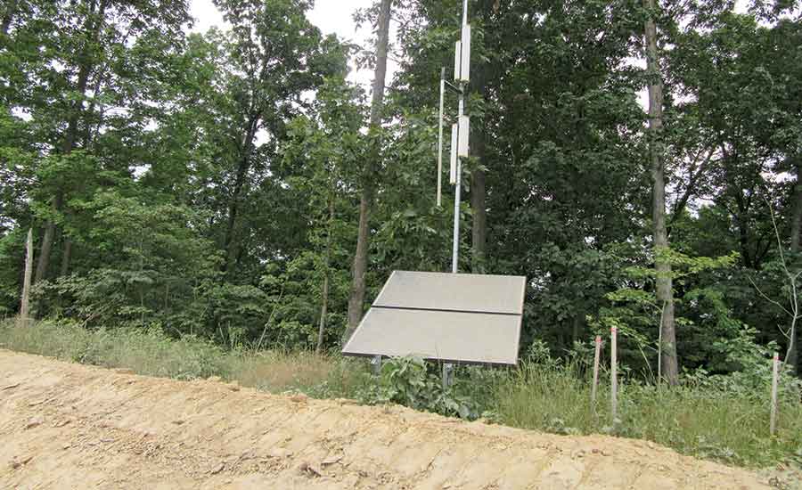
Inspectors equipped with mobile forms containing all construction requirements can quickly filter through thousands of requirements to obtain those applicable to the work currently being observed. Photos are the key source of documentation. The tool automatically logs and tracks nonconforming work issues when identified. Personnel can use a tablet or even their phones to collect data, including marked-up photos with stations and offsets. Upon submission, the information gets saved to the cloud and sent to a secure CH2M server in Denver. The mobile data collection system works online or offline, but that is never an issue because the project is equipped with a 16-mile solar-powered Wi-Fi network.
The information is shared via webpages from CH2M’s servers to anyone on the project with an internet connection. When the database is updated, any impacted mobile form lookup list is automatically pushed out to the inspector’s device. All form submissions have an associated geolocation, so the data can be displayed on a map, and all project assets have an associated GIS shape. Color-coded maps are provided to display the status of the asset. Those in need of attention are displayed in red, while other conditions are either yellow, orange or green. A photo query enables users to filter through thousands of images by the data automatically attached to the photo when it was taken. The webpages in the CQRS have form submission queries, reports, GIS maps, images and other data such as aggregation pages. The relational database enables users to filter through the data instantly.
Whether it’s a QC form, a verification of requirements or an inspector daily report, it is all searchable by the asset. Assets are derived from the project schedule. There are around 1,400 activities performed in the SR 823 project. Approximately 900 of them directly translate to a noun, or an asset, such as “Bridge 20, Forward Abutment Wing Walls.” Since all captured data is relative to an asset, and access to the information is provided on a map, users can search and recover data either during construction or throughout the operations and maintenance period regardless of their familiarity with the project.
“The CQRS has been developed with the idea that risk-based inspection means building and tracking a focused inspection plan crafted around the owner’s perceived risk tolerance for each project,” says Parsell. “That means setting verification percentage goals on the assets of the project. If there is perceived to be a high-risk asset in a project, say an asset with a post-tensioned element for instance, the owner may want a higher percentage of that type of work to be verified. The CQRS has enabled our team to track conformity of the work, along with the quantity of the work that has been verified. Since all collected data has been associated to a GIS shape, you can graphically display the results, which is pretty cool.”


