Update 3 p.m. 9/1/19
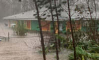
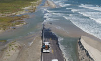
As category 5 Hurricane Dorian roared over Abaco Islands and headed toward the Grand Bahamas with 185 mph winds Sunday, precautions were being put in place from southern Florida to Virginia because of the storm’s uncertain path.
“Although the exact [National Hurricane Center] track forecast lies east of the Florida peninsula, a track closer to the coast or even a landfall remains a possibility late Monday through Tuesday night,” according to the National Hurricane Center’s 2 p.m. Sunday update.
The storm had been expected to make landfall on Florida’s east coast Tuesday afternoon as a category 4 storm. The track has shifted east, however, and the storm is now expected to skirt the Atlantic Coast through Friday morning. No landfall has yet been projected.
The hurricane center is forecasting heavy rainfall and flash floods with rainfall amounts expected to range from 2 inches to 15 inches.
Terry Snow, Southeast Region director and senior vice president for Gannett Fleming, was securing his coastal South Carolina home Sunday afternoon while also coordinating with the others in the company to prepare and be ready to assess damage after the storm passes.
The company will be working on several fronts after the storm passes, including with the Florida Department of Transportation. Gannett Fleming manages a traffic center in Chipley, Fla., and will assist in an evacuation if one is called.
The company has also reached out to officials in the Carolinas and in Georgia to offer their assistance
“We are mobilizing our staff for inspections of infrastructure for after the storm passes,” Snow says. “It could be any multitude of things,” from inspections of bridge and culverts, railroad stations and yards, water treatment plants, industrial building systems and dam inspections.
Snow says that if the storm stays off the coast, that flooding will be the main problem, but if it comes ashore the area impacted will be affected by storm surge and power outages.
“What we are finding is that every situation is different,” he says. “ We are prepared as best we can be at this point.”
8/27/19
Construction sites are being shut down and coastal engineers are being put on alert in advance of Hurricane Dorian, expected to make landfall on Tuesday afternoon on Florida’s east coast as a category 4 storm.
The U.S. Army Corps of Engineers, Jacksonville District, has been closely inspecting the Herbert Hoover Dike around Lake Okeechobee. The dike is being rehabilitated. District Cmdr. Col. Andrew Kelly, says the dike is in better shape than it was when Irma hit last year, there is still concern about the structure on its northwest corner.
“We don’t anticipate any overtopping or breaching,” he said during a news conference call. The work at the dike, anticipated to last until 2022, includes construction of about 20 miles of cutoff walls and 17 culvert replacements.
The lake’s current level is 13.66 ft. Kelly says that another with the storm and subsequent rain and runoff the lake is expected to rise about 3 ft over the next month. The lake’s highest recorded level was 18.7 ft.
The Corps has six teams of coastal engineers standing by to inspect its 15 coastal shore protection projects under construction.
Construction at all of the Corps projects is being shut down based on contract specifications.
One of the biggest concerns appears to be rainfall should the storm stall over central Florida, as expected.
“We are tracking the storm closely as NOAA/NHC/NWS are anticipating rainfall totals to exceed 10-15 inches with riverine flooding expected along major rivers and isolated surge events along the coastline,” says Jason Bird, Florida resilience practice lead for Jacobs. “We are urging folks to heed the warnings of local officials and prepare in advance to stay safe, and pray there are no fatalities associated with this storm.”


