NOAA Says 2019 Floods Caused $6.2B in Damage, Expects More

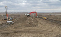
Damage in Nebraska from flooding was exacerbated by frozen ground swelling rivers.
PHOTO BY JEFF YODERS FOR ENR
Flooding on the Mississippi River and its tributaries throughout Illinois, Iowa, Missouri, Nebraska and nine other states caused an estimated $6.2 billion in damage in 2019, the National Oceanic and Atmospheric Administration said in its annual National Climate Report, released Jan. 15.
The total amount from last year’s Midwest flooding places it as the 51st costliest weather disaster since NOAA began tracking the cost of floods, hurricanes, severe storms, droughts, wildfires and winter storms in 1980. There is no immediate end in sight to the heavier rains and other effects of climate change, NOAA scientists said.
Nationwide, 2019 was the second-wettest year on record since NOAA began tracking rainfall, Derek “Deke” Arndt, chief of the climate monitoring section at NOAA’s center for weather and climate in Asheville, N.C., said in the report.
The average annual precipitation in the lower 48 states was 34.78 in., which is 4.84 in. above the long-term average, making it the second-wettest year ever. The wettest was 1973.
NOAA reported record precipitation across the northern plains, Great Lakes and portions of the central plains. North Dakota, South Dakota, Minnesota, Wisconsin and Michigan each had their wettest year on record in 2019. This was the second year in a row when the Midwest set a regional record for wettest year with 46.09 in. of precipitation—three inches more than the previous record of 43.06 set in 2018.
The cost of damage and losses to farms, infrastructure, crops, river barge traffic and related industries was included in the final damage figure. NOAA included damage information from all states that border the Mississippi River—Minnesota, Wisconsin, Iowa, Illinois, Missouri, Tennessee, Arkansas, Mississippi and Louisiana—as well as Texas, Kansas, Nebraska and Oklahoma. The report also noted that as more precipitation falls in the form of rain rather than snow, flooding is more likely. When winter snowpack melts, the ensuing water gradually seeps into soil. When rainfall sweeps over frozen ground, as it did in Nebraska, South Dakota, Iowa, Missouri and Wisconsin during the “bomb cyclone” in March and April, it makes its way into the region’s streams and rivers more easily, the report said.
The bomb cyclone situation “developed in the central U.S. bringing snow, blizzard conditions, heavy rainfall and above-freezing temperatures across the interior U.S., which already had significant snowpack on the ground from the winter of 2018-19. This resulted in widespread flash flooding due to the combination of new rainfall, rapidly melting snow and frozen ground,” according to the report.
The Missouri, Platte and Mississippi rivers all breached their banks and flooding continued into July along the Missouri, Mississippi, Platte and Arkansas rivers due to ongoing heavy rainfall. “The combined cost of the Missouri, Arkansas and Mississippi river flooding ($20.0 billion) was almost half of the U.S. cost total in 2019,” reports NOAA.


