Scan Data Aids Tsunami Engineers Inquest


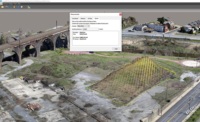
Engineering researchers are dissecting troves of data about the performance of structures hit by the Japanese tsunami of March 11. One of their sharpest tools is light imaging and ranging scan data. It captures distortion in exquisite detail.
“We started talking about this [LiDAR] right after the earthquake,” says Michael Olsen, a professor of geomatics at Oregon State University.
Olsen is the terrestrial LiDAR expert on a team convened by the American Society of Civil Engineers to analyze the tsunami's loads and the performance of structures and coastal engineering.
The team, coordinating with Japan's Building Research Institute, has sent two missions into the damage zone. The first, in April (ENR 5/9 p. 12), identified targets for deep analysis and secured material samples and measurements. The second included two of Olsen's graduate students, Shawn Butcher and Evon Silvia, who followed up to collect stationary scan data in late June, under the guidance of Lyle Carden, a structural engineer and principal at Martin & Chock Inc., Honolulu. The company's president, Gary Chock, leads the ASCE team.
“They [Butcher and Silvia] were the field crew,” says Olsen. “They collected an estimated four-billion data points—100 gigabites of data—in 10 days.”
Ian Robertson, a civil engineering professor at the University of Hawaii at Manoa, is the LiDAR study's principal investigator. He is working with Kwok-Fai Cheung, a professor of ocean and earth science and technology at the university, to plan follow-up modeling and simulations. On Nov. 2, they expect to submit an application for funding to the Network for Earthquake Engineering Simulation, a consortium of research institutions founded by the National Science Foundation to aggressively seek ways to improve infrastructure seismic performance and design.
The LiDAR field crew collected topographic surveys to improve inundation models as well as data on specific structures identified by the ASCE/ BRI teams. Work now focuses on buildings that have full scans, plus structural data collected in April.
The team also is making use of mobile scan data captured by Asia Air Survey Co. The company had just acquired a StreetMapper mobile mapping system from U.K.-based 3D Laser Mapping, when the quake hit. On April 20, it tested the device by rapidly scanning a 100-meter-wide swath along 100 kilo-meters of road around Sendai. When the firm learned ASCE had been working in the area at the same time, it offered the data. “It was great that they were willing to give us their data,” says Olsen.
The mobile scans helped tie together stationary scans the June team took from high ground. “Where there was no direct line of sight between our points of reference, we were able to use the Asia Air Survey data for geo-reference to create a unified LiDAR model,” Chock says.
The mobile scan data included a 2-km-long swath on the road into the devastated town of Onagawa, where the ASCE's first field crew had targeted numerous structures for analysis. “The two data sets really complement each other very well,” Olsen says.


