New Eased Drone Rules Aid Landslide Monitoring Efforts

Unmanned aerial systems get high-resolution cameras closer to possible landslide areas than manned aircraft can. This quadcopter can get within 100 ft of landslides to gather 3D data.
PHOTO COURTESY OF WOOLPERT

A 3D image of a landslide made from drone-collected photos taken in quick succession.


Unmanned Aerial Systems pilots are flying close to landslide-prone terrain to collect higher-resolution elevation data than traditional aerial imagery can deliver, and they’re doing missions in scant hours—putting near real-time monitoring of dangerous slopes within practical reach. That capability could help prevent deadly events such as the 2014 mudslide in Oso, Wash., that killed 43 people.
Additionally, the Federal Aviation Administration’s new “Part 107” regulations take effect Aug. 29. That will ease the burden on doing such work, says Aaron Lawrence, a GIS expert and UAS technology developer for geospatial consultant Woolpert, Dayton, Ohio. Lawrence’s team already measures land moves after landslides. Now it seeks to spot risky locations before they fail.
“We’ve done some work like this in the past, but not at this resolution,” says Lawrence. His firm has used manned aircraft for similar work but he says piloted aircraft can only get within 1,000 ft of landslides. Now he flies the same cameras and captures images from only 100 ft, and creates 3D models to boot.
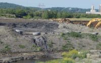
“We get 3D data using one camera,” says Lawrence. The camera shoots in such rapid succession that there’s a 70% to 80% overlap in the images. That can be used to create a 3D model. One recent job created 3D data after a slope failure on a newly developed parcel in West Virginia.
“When you move to three dimensions and high resolution, you can see cracks in the boulders and where the vegetative surfaces might actually help keep the land together,” says Lawrence.
West Virginia’s Dept. of Transportation and Dept. of Natural Resources are able to use this kind of data, especially after recent extreme weather. “We’re seeing flooding like we’ve not seen before,” says Lawrence. “We’re asked to deploy UAS to collect high-resolution data to report land [movement], predictions, mitigations, as well as post-landslide imagery and 3D data.”
Lawrence says the FAA’s Part 107 release eases existing drone flight restrictions affecting permissible altitude and proximity to non-flight personnel.
“Part 107 should spur more small business,” says David Gallagher, chief of staff at the Ohio Dept. of Transportation’s Ohio/Indiana UAS Center. “When I first started here last summer no commercial operations were happening. Now a lot of film companies, aerial photo and bridge inspection companies are contacting me for help.”
The Ohio/Indiana UAS Center is a government-funded resource to spur growth of small business in Ohio and Indiana. Gallagher has helped local startups get paperwork, such as certificates of waiver or authorization, through the FAA in recent years.
Gallagher says the easing of regulations will help people interested in starting drone companies enter into what he says is predicted to become a $113-billon industry by 2026. “They won’t have to hire attorneys and submit waivers,” says Gallagher.
The new rules will raise the flight ceiling above 400 ft in the proximity of a tall subject, which Lawrence says is great for tower inspection. Another big change is to the nonparticipant rule. Currently nonparticipants cannot be within 500 ft of drone operations. Under the new rule drones merely are not permitted to fly directly over nonparticipants on a project site.


