Canadian Company Proposes to Cut Pipeline Monitoring Costs with Automated Drones

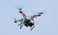
Toronto-based SkyX hopes to crash into the $37-billion global pipeline monitoring business with a far less expensive, more effective, automated drone-based alternative than current practices. -- Rendering courtesy of SkyX
According to the U.S. Dept. of Transportation’s Pipeline and Hazardous Materials Safety Administration, as well as Deloitte Consulting, the global oil and gas industry spends $37 billion a year monitoring nearly 10 million kilometers of pipelines.
SkyX, a Toronto-based aerospace company, hopes to cash in on that market with a drone-based monitoring system it claims not only could reduce traditional monitoring costs by nearly 90%, but also, using patented technology, provide more comprehensive information faster by employing artificial intelligence to recognize issues and recommend interventions. It says a pilot project in West Canada with an unidentified gas company is scheduled to begin in August.
Didi Horn, a drone pilot, the company’s founder and a former captain in the Israeli Air Force, says savings will come from the reduction of operational and capital costs associated with manned vehicles and aircraft traditionally used to detect damage or threats to pipelines. In addition, Horn says the technology also minimizes the hours now required for monitoring.
“SkyOne can travel at 150 km per hour for 70 minutes and detect leaks, vandalism, vegetation encroachment, and so much more,” Horn says, adding that a key advantage of the system is the UAV’s ability to automatically land, recharge and upload its data via hard-wired connections at stations positioned approximately 100 km apart—the same distance that typically separates pipeline pumping stations.
He says that manned vehicles and helicopters are limited in the amount of time they can monitor a pipeline, whereas a flock of his drones could provide around-the-clock data collection and near real-time video, potentially offering a far wider scope of information, updated more frequently, for pipeline operators.
“Our drone doesn’t need to return to a home base to recharge. Instead, it flies to the next xStation, where it recharges in a weather-shielded dome before continuing its mission,” Horn says, adding, “the recharging stations can also be operated off the grid because they can be powered by generators and solar panels.”
According to Horn, when drones reach the next xStation, all the video it collects from that segment will be downloaded and sent for review. He says the drone also will send alerts of any pipeline damage or irregularities detected by A.I. processing, before it downloads its video.
Horn says that to monitor the proposed 3,000-mile-long Keystone Pipeline, planned to extend from Canada to the Gulf of Mexico, one drone could cover the entire length every 12 to 15 days. A fleet of 30 drones could cover every inch of the pipeline, every hour.
“The increased frequency of surveillance by our drones makes possible leaks or damages reportable much more quickly,” Horn says. “Many times when there’s a pipeline leak in remote areas they are reported by the public before the oil and gas company monitors even know.”
The general public first reported 22% of the pipeline spills that occurred in the U.S. between 2002 and July, 2012, while remote sensors detected only 5% of them, according to the Pipeline and Hazardous Materials Safety Administration.
Richard Kuprewicz, president of Accufacts, Inc., a consulting firm that provides pipeline expertise for government agencies, says, “it’s just real difficult to detect leaks remotely.” He says flying aerial surveillance with a drone—as opposed to a manned aerial vehicle—should have advantages both in cost and efficiencies. Also, “it should be able to get closer to the pipelines,” he says. “Mr. Horn’s claim has a ring of truth to it.”

