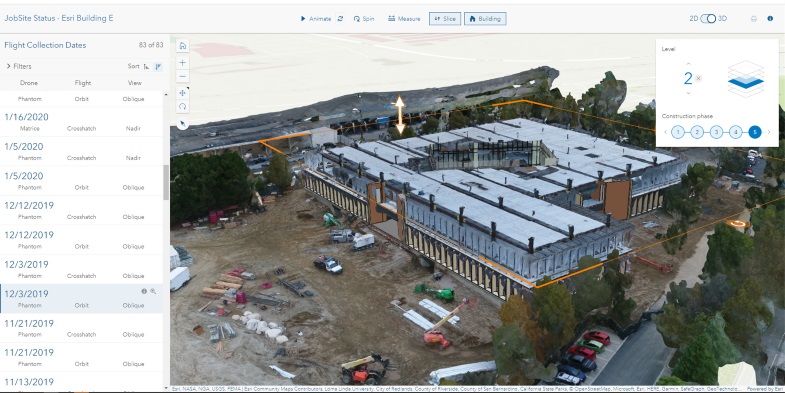
On February 7 , Esri launched ArcGIS Reality, a suite of products for site, city and countrywide reality mapping that uses the ArcGIS Reality Engine.
The new software suite includes ArcGIS Reality, a part of Esri's ArcGIS platform that lets users input images from drones or crewed aircraft to generate 3D outputs such as point clouds for mapping. ArcGIS Reality Studio allows for reality mapping from aerial images for entire cities and countries while Site Scan for ArcGIS is a cloud-based, end-to-end reality mapping software for drone imagery, designed for data collection, processing and analysis. ArcGIS Drone to Map is a new desktop application focused on reality mapping from drone imagery, enabling offline processing and in-the-field rapid mapping of drone images.
Kurt Schwoppe, Esri's business development manager for imagery, says the new offerings were driven in part by the rapid expansion of the use of drones and the reality capture market, but also by engineers' and contractors' use of reality capture products. Being able to more easily move that data to ArcGIS was an objective, according to Schwoppe who previously worked for reality capture hardware provider Leica Geosystems and was an officer in the U.S. Army Corps of Engineers.
"When I first got started in the imagery business, it was very much kind of the land/satellite, very broad area of business," he says. "As time has gone on, the resolutions have gotten better and now with the drones in place we've really gotten high level of detail that they're able to capture and really starts catering to that whole AEC marketplace."
Schwoppe says some of the use cases being made in favor of a digital tool like Site Scan for ArcGIS are from building owners looking to check the performance of rooftop-mounted equipment such as solar panels.
Esri introduced its ArcGIS GeoBIM product in 2022 and has added more connections with products from Autodesk to make moving data between GIS and building information modeling systems easier with less need to rework and re-create data. As a result, a more robust suite of products to move reality capture data—no matter how its recorded by drone photos, video, meshes or point-clouds of site data—to the ArcGIS platform was necessary, says Scwoppe.
Competing reality capture data management platform DroneDeploy recently acquired another competing platform, StructionSite, further consolidating the marketplace, and the reality capture data management sector continues to draw investment from venture capitalists.


_ENRready.jpg?height=200&t=1721243084&width=200)