- NEWS
- PROJECTS
- BUSINESS
- TALENT
- REGIONS
- TECH
- PRODUCTS
- IDEAS
- COSTS
- LISTS
- INFOCENTERS
- EVENTS
- Award of Excellence
- Best of the Best Project Awards
- FutureTech
- Groundbreaking Women in Construction EAST
- Groundbreaking Women in Construction WEST
- Global Best Projects Awards
- LA Infrastructure Forum
- NY/NJ Infrastructure Forum
- Regional Best Projects
- Seattle Infrastructure Forum
- Top 25 Newsmakers
- Upcoming Events
- Webinars
- MORE
Articles by Jeff Yoders
Construction
Contaminants were found on South Side vacant lot, IEPA says project will not move forward without further site remediation
Read More
EVs Bring Big Shifts to Construction of Manufacturing, Infrastructure and Charging Networks
To meet 2035 goals, designers are testing charging technology, while automakers are becoming their own contractors
Read More
Economics
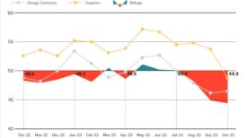
Architecture Billings Index Falls Again in October
Measure of architecture firm business conditions shows decline for three straight months
Read More
Construction Technology
Autodesk, Trimble Tout More Data Sharing and Embrace of AI
Tech firms promise construction-focused use of artificial intelligence and better interoperability
Read More
Materials
Reflection Window + Wall Secures Renewable Power for India Plant
Sustainable energy will produce all of the Chicago-based window-maker's aluminum products
Read More
Materials
Army Corps to Require Design Teams to Consider Mass Timber
New policy mandates all vertical construction projects must consider mass timber and cross-laminated timber in design
Read More
Transit-oriented Development
HUD, DOT Change Guidance to Promote Office-to-Residential Conversions
New language allows some housing initiatives to apply for loans and other funding
Read More
The latest news and information
#1 Source for Construction News, Data, Rankings, Analysis, and Commentary
JOIN ENR UNLIMITEDCopyright ©2025. All Rights Reserved BNP Media.
Design, CMS, Hosting & Web Development :: ePublishing


